

Processing payment...


Garmin ETREX30X 2.2 inch eTrex 30x Handheld GPS
Sold Out
Deal Price$238.99
Suggested Price$299.99
You save 20%
Protect Your ProductLearn More
Important DetailsRelated Products
Description
Specs
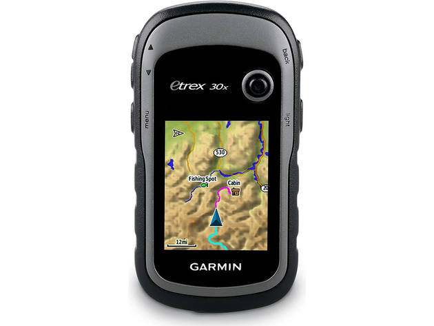
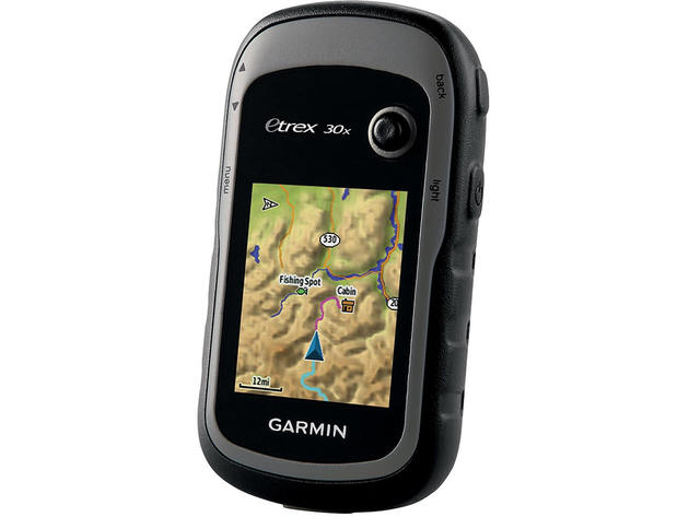
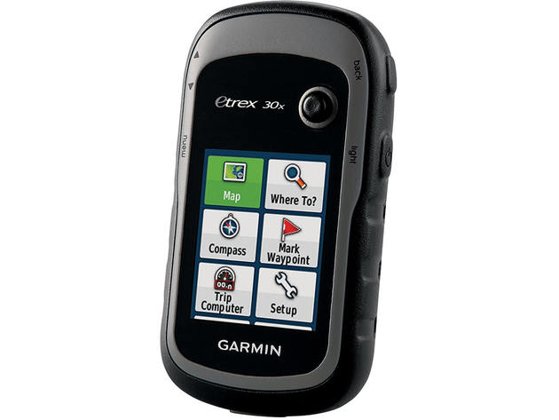
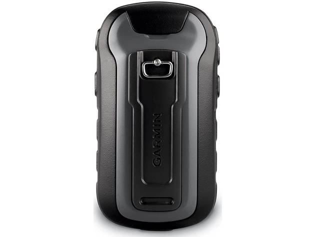
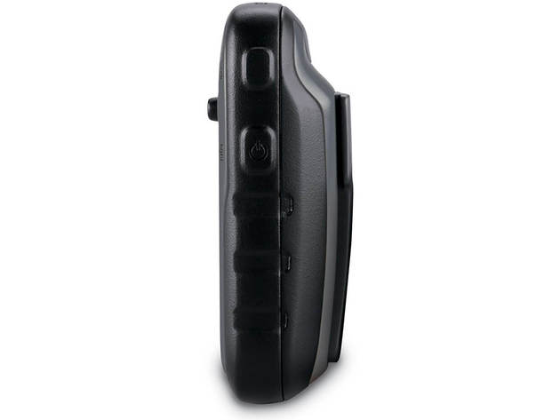
The Garmin eTrex 30x features an enhanced screen resolution and an expanded internal memory so you can have improved readability and more maps. The enhanced 2.2" screen includes 65K color and sunlight-readability with an upgraded interface. Durable and water resistant the eTrex 30x can withstand dust dirt humidity and water. Additionally the eTrex 30x includes a 3-axis tilt-compensated electronic compass that shows your position without holding it level as well as a barometric altimeter so you know your precise altitude at all times and can watch out for changing weather conditions.
See the Way
eTrex 30x has an enhanced 2.2-inch 65K color sunlight-readable display. Durable and water resistant eTrex 30x is built to withstand the elements. It has an upgraded interface yet retains its legendary toughness to withstand dust dirt humidity or water.New Tools for Your Trek
eTrex 30x adds a built-in 3-axis tilt-compensated electronic compass which shows your heading even when youre standing still without holding it level. Also added is a barometric altimeter which tracks changes in pressure to pinpoint your precise altitude and you even can use it to plot barometric pressure over time which can help you keep an eye on changing weather conditions.Go Anywhere
With an array of compatible mounts eTrex 30x is designed as a handheld or for use on ATVs bicycles in boats cars even hot air balloons. Use the auto mount capability and City Navigator NT maps for turn-by-turn driving directions or the rugged mount for your motorcycle or ATV. Wherever you think you might take eTrex it has the mapping and mounts to get you there.Go Global
The eTrex series is the first-ever consumer-grade receivers that can track both GPS and GLONASS satellites simultaneously. When using GLONASS satellites a system developed by the Russian Federation the time it takes for the receiver to lock on to a position is (on average) approximately 20 percent faster than using GPS. And when using both GPS and GLONASS the receiver has the ability to lock on to 24 more satellites than using GPS alone.Add Maps
With its microSD card slot and expanded 3.7 GB of internal memory eTrex 30x lets you load TOPO 24K or Garmin HuntView maps and hit the trail plug in BlueChart g2 preloaded cards for a great day on the water or City Navigator NT map data for turn-by-turn routing on roads. eTrex 30x also supports BirdsEye Satellite Imagery (subscription required) that lets you download satellite images to your device and integrate them with your maps.Share Wirelessly
Wirelessly connecting to a variety of compatible Garmin devices including VIRB action cameras and ANT+ sensors (including a heart rate monitor) the eTrex 30x can also read from and write to the chirp wireless beacon or link with your trail buddys Oregon Montana GPSMAP 64 or other ANT+-enabled outdoor navigation devices.Keep Your Fix
With its high-sensitivity WAAS-enabled GPS receiver and HotFix satellite prediction eTrex locates your position quickly and precisely and maintains its GPS location even in heavy cover and deep canyons.Find Fun
eTrex 30x supports geocaching GPX files for downloading geocaches and details straight to your unit. Visit Geocaching.com to start your geocaching adventure. By going paperless you're not only helping the environment but also improving efficiency. eTrex 30x stores and displays key information including location terrain difficulty hints and descriptions which means no more manually entering coordinates and paper printouts. Simply upload the GPX file to your unit and start hunting for caches.Plan Your Next Trip
Take charge of your next adventure with BaseCamp software that lets you view and organize maps waypoints routes and tracks. This free trip-planning software even allows you to create Garmin Adventures that you can share with friends family or fellow explorers. BaseCamp displays topographic map data in 2-D or 3-D on your computer screen including contour lines and elevation profiles. It also can transfer an unlimited amount of satellite images to your device when paired with a BirdsEye Satellite Imagery subscription.Shipping
- Ships to Contiguous US
- Expected Delivery: Jun 27 - Jul 1
Terms
- Returns accepted within 30 days of shipment for orders within the Contiguous US.
- This item is excluded from coupons.
Your Cart
Your cart is empty. Continue Shopping!
Processing order...